Canyon Street Map
showing the five neighborhoods

The Canyon in Maps
Historic, topographic, and other maps from the exhibition, “Mapping the Canyon for Recovery”
Click here for a selection of the historic and contemporary maps and photographs from the exhibit, created by Doug Suisman, which was on display at Gallery 169 in Canyon Square in March 2025.

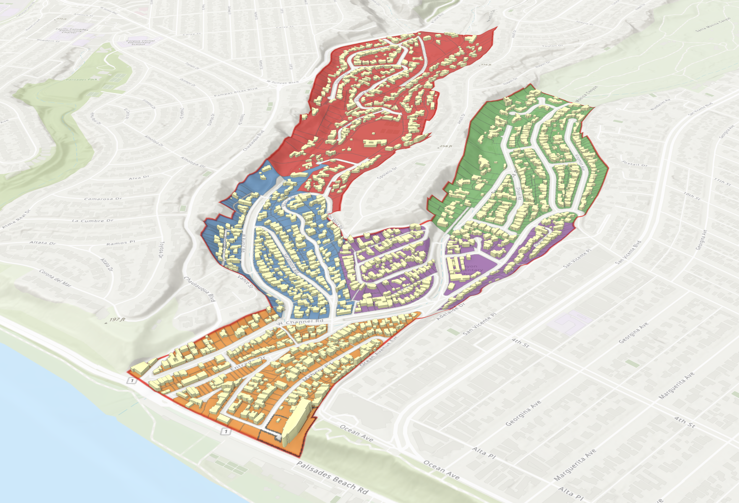
Interactive 3-D Map of the Canyon
including its topography, five neighborhoods, parcels, structures, and associated data
Since early April, Professor Liu Jing and her geography students at Santa Monica College have been generously working with the Canyon Alliance on a post-fire mapping project of the Canyon, with the goal of increasing our resilience through geographic knowledge. See article here
As a first step, student Jason Runnells created this extraordinary interactive three-dimensional map of the Canyon, showing our topography, all five of our neighborhoods, and every parcel and structure in the Canyon. You can click on each parcel or structure for detailed information.
The map’s contents were derived from the public information available on the GIS (geographic information systems) website of the City of Los Angeles.
The students continue this spring to explore the Canyon through mapping and will make their work available to The Canyon Alliance and the community at the end of the semester in June.